


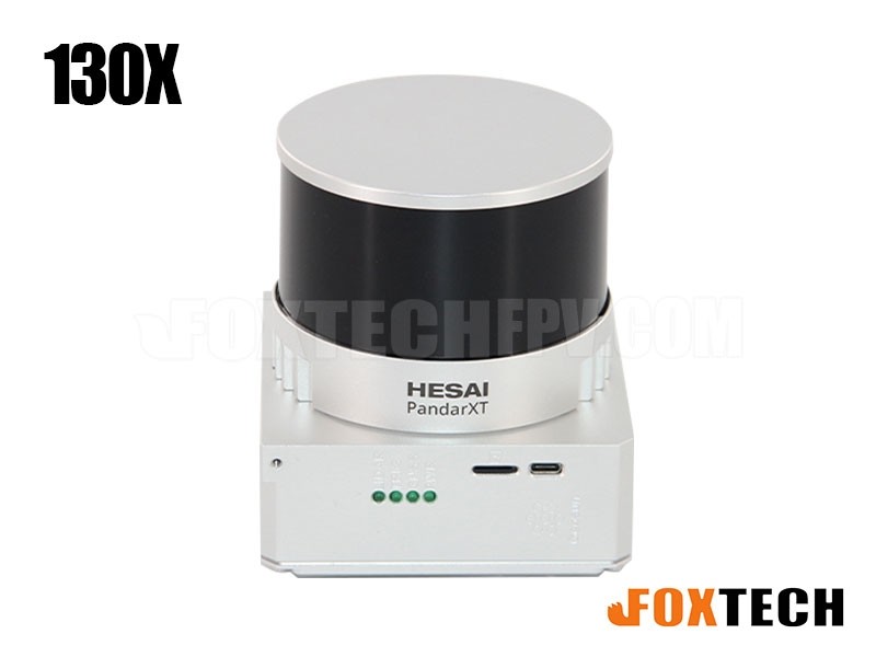
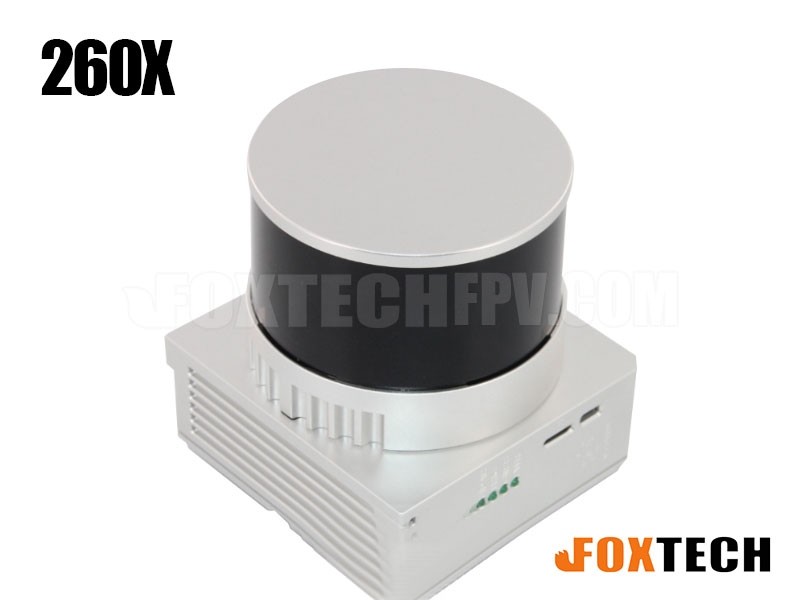


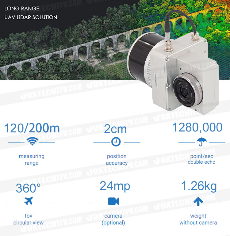
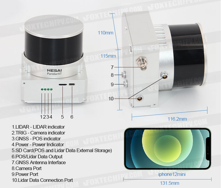
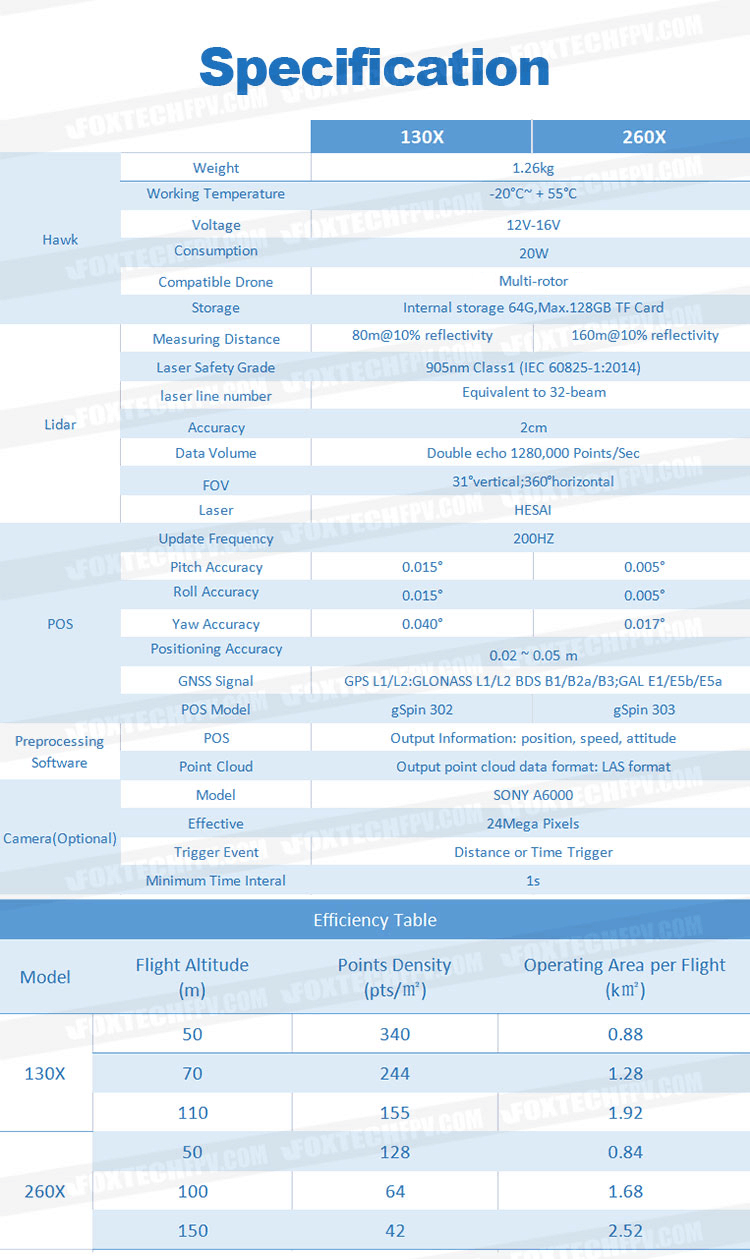
Foxtech Hawk-130X/260X is a compact and light weight Lidar point cloud data acquisition system, integrated with the new generation laser scanner HESAI PandarXT, high precision GNSS and IMU positioning system, which is able to real-time, dynamically, massively collect high-precision point cloud data and rich image information. It is widely used in the acquisition of 3D spatial information in surveying, electricity, forestry, agriculture, land planning, geological disasters, mine safety.
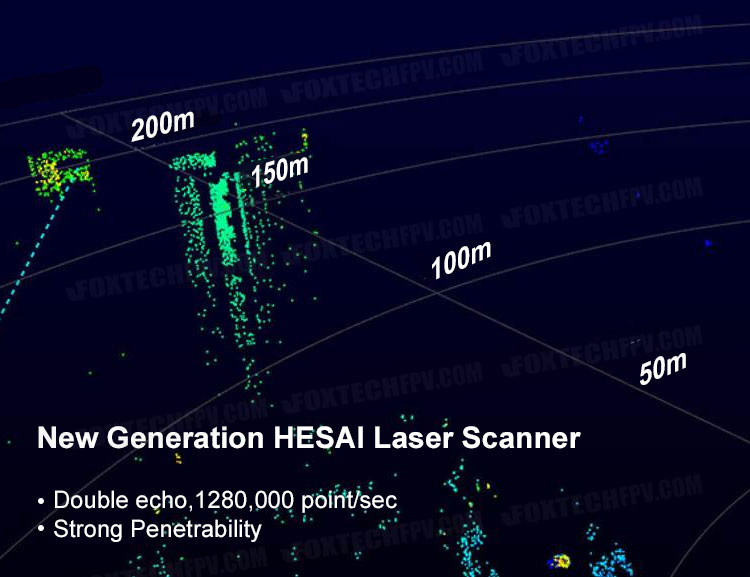
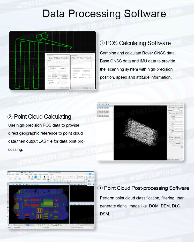
Hawk-130X/260X Lidar Scanning System features 360°field of view, high point-density (double echo, 1280,000 point/sec), high accuracy and light weight, only 1.26kg. Mounted on multi-rotors it can quickly obtain the three-dimensional position and attribute information of ground objects in a large area, then generate digital image like DOM(with integrated camera), DEM, DLG, DSM by using data processing software.
Hawk-130X/260X positioning and attitude measurement system consists of high precision GNSS and IMU, the integration of which is used for differential positioning and orientation to provide instantaneous position, speed and attitude information (pitch, roll, yaw).
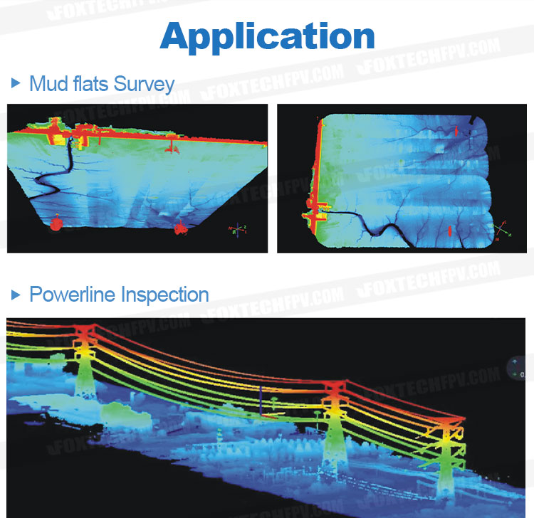
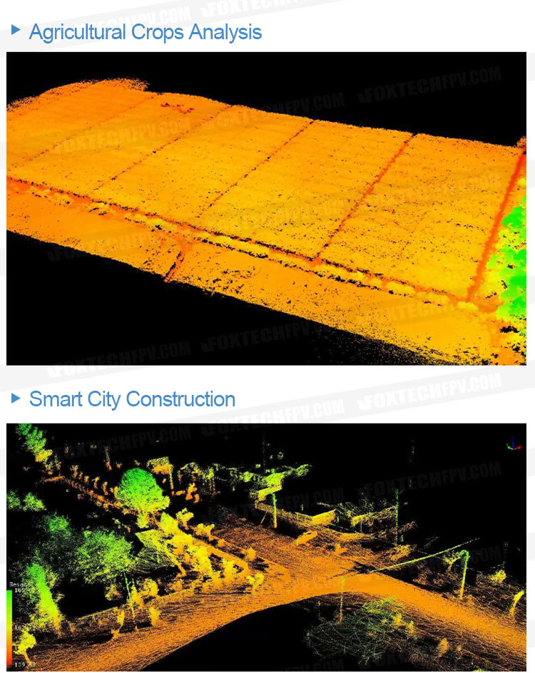
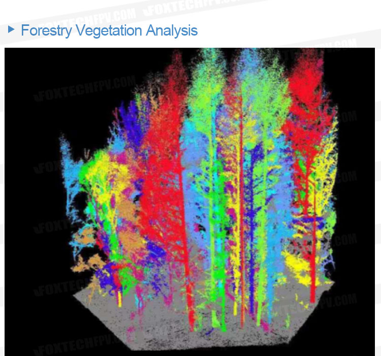
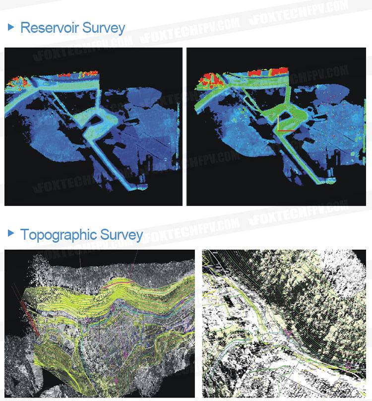
Owe to the light weight and compact size, Hawk-130X/260X Lidar can be used for many different applications, such as objects classification and extraction, creating digital elevation models (DEMs) of specific landscapes, mapping flood risk and monitoring coastal erosion, highlighting changes and abnormalities of vegetation growth.
Your Purchase Includes:
1x Foxtech Hawk-130X/260X Lidar Scanning System (without camera)
1x GNSS Antenna
1x 128G TF Card


