


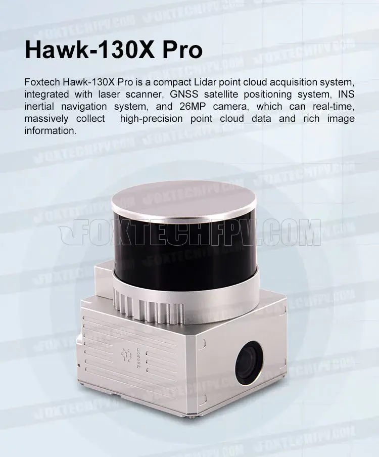
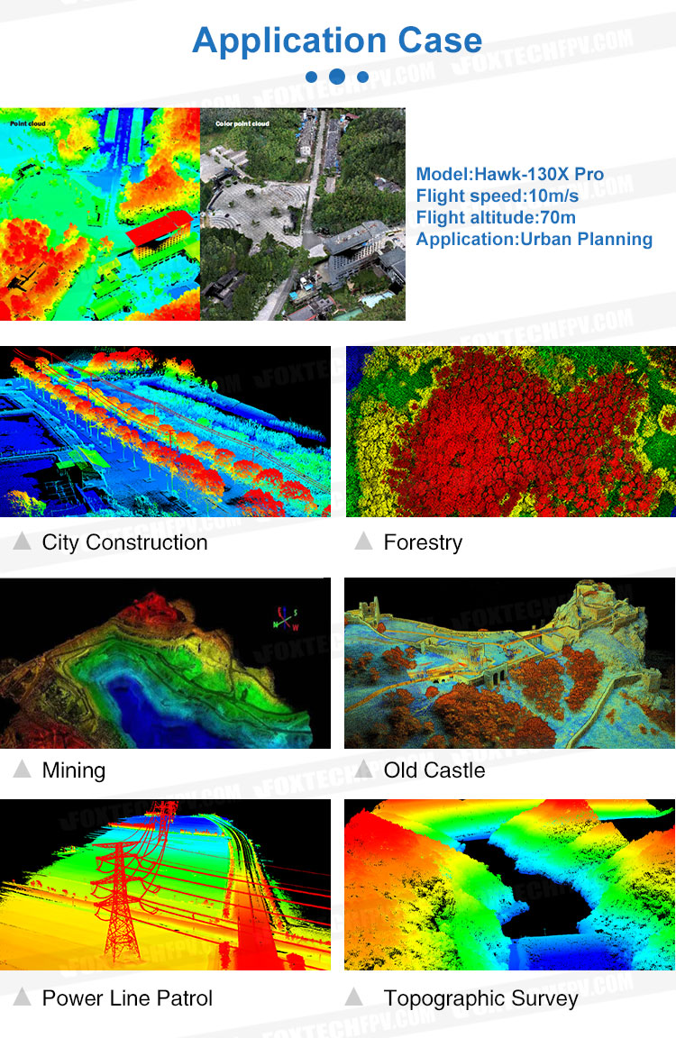
Foxtech Hawk-130X Pro is a compact Lidar point cloud acquisition system, integrated with laser scanner, GNSS satellite positioning system, INS inertial navigation system, and 26MP camera, which is able to real-time, massively collect high-precision point cloud data and rich image information. It is widely used in the acquisition of 3D spatial information in digital city construction forestry, agriculture, land planning.
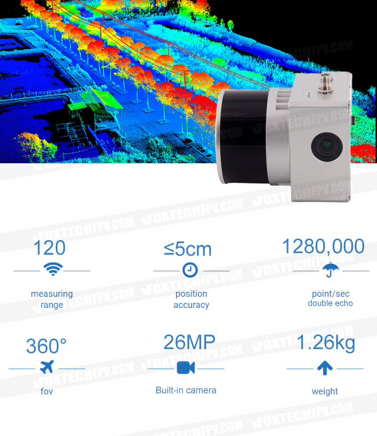
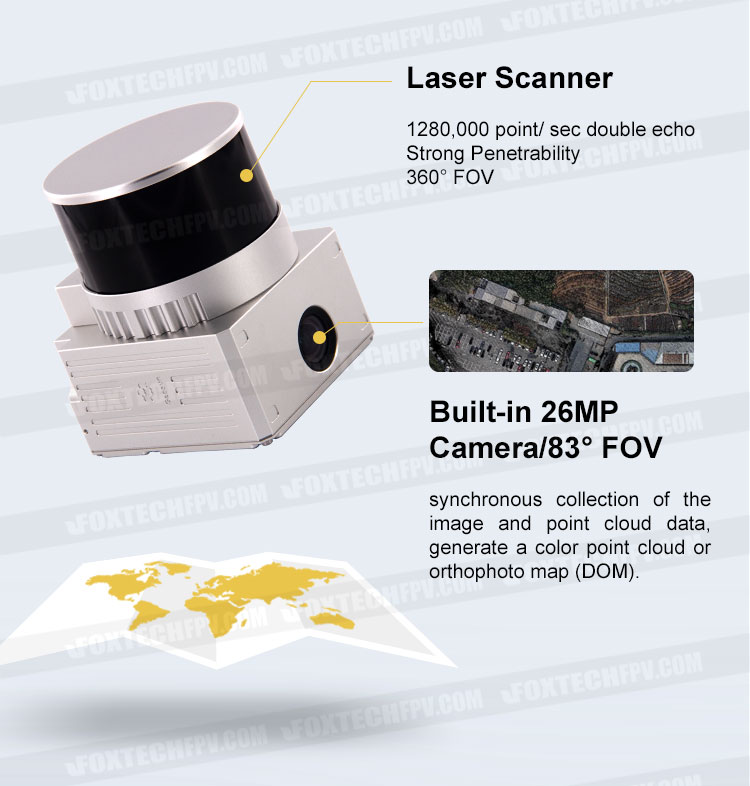
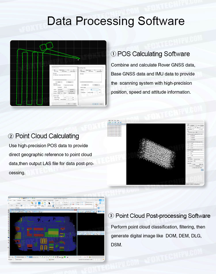
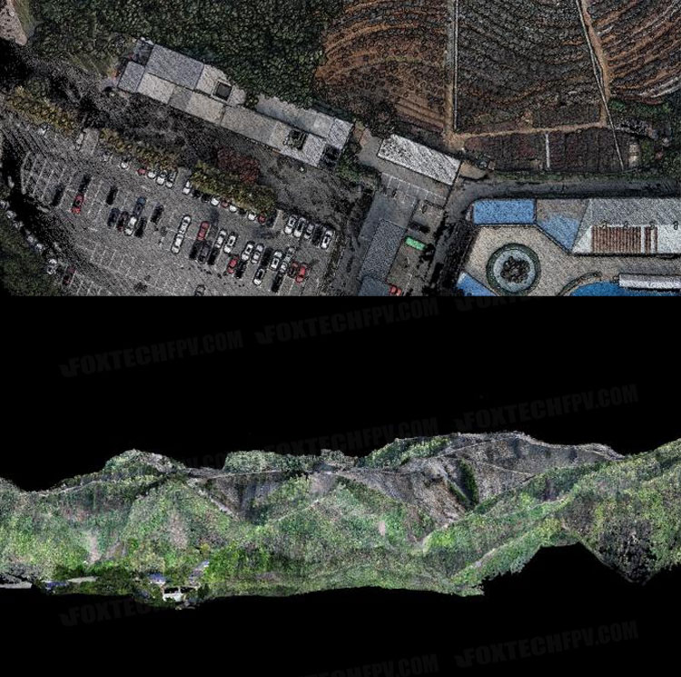
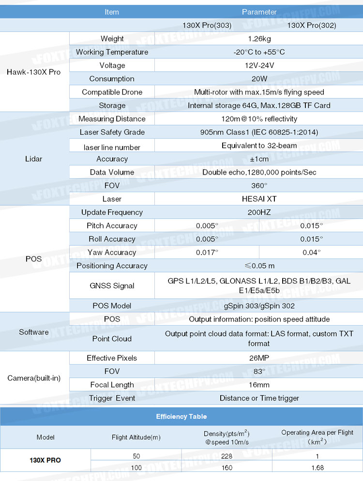
Hawk-130X Pro Lidar Scanning System features 360° FOV, high point-density (double echo, 1280,000 point/sec), high accuracy and light weight, the positioning accuracy is less than 0.05m, it can quickly obtain the three-dimensional position and attribute information of ground objects in a large area, then generate digital image like DOM, DEM, DLG, DSM by using data processing software.
Hawk-130X Pro Lidar can be used for many different applications, such as objects classification and extraction, creating digital elevation models (DEMs) of specific landscapes, highlighting changes and abnormalities of vegetation growth.
Note: The mounting board is not included. Please contact customer service for customization.
Your Purchase Includes:
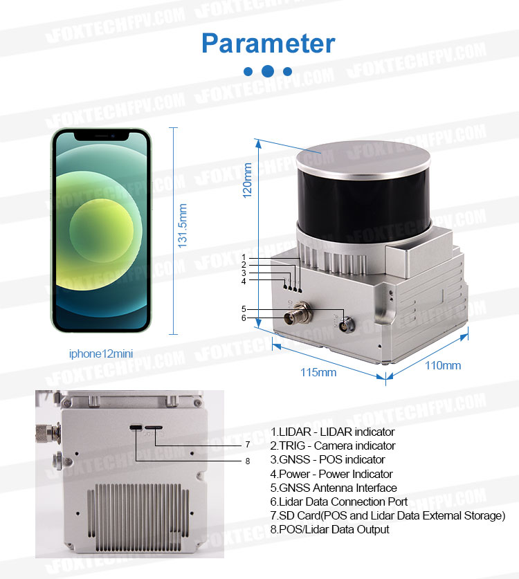
1x Foxtech Hawk-130X PRO Lidar Scanning System
1x GNSS Antenna
1x GNSS Cable
1x Power Connection Cable
1x MICRO SD Card 128 GB
1x U Disk
1x Carry case


