


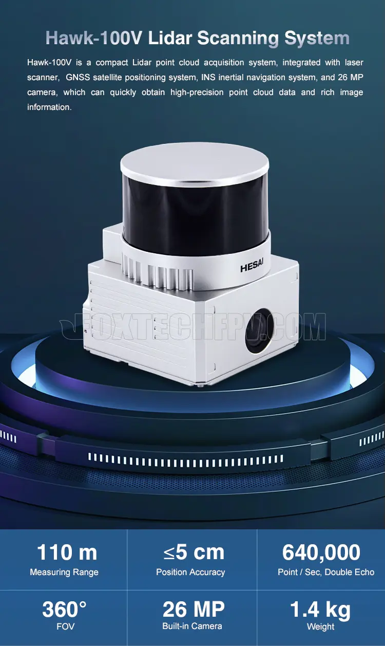
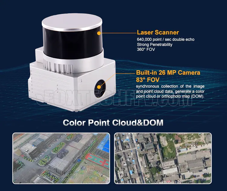
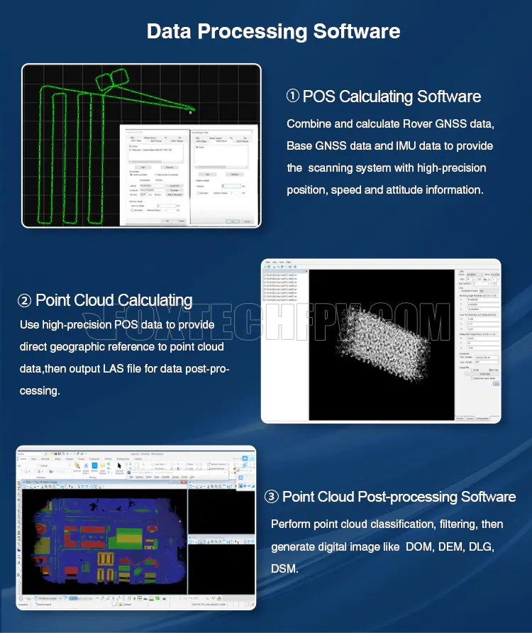
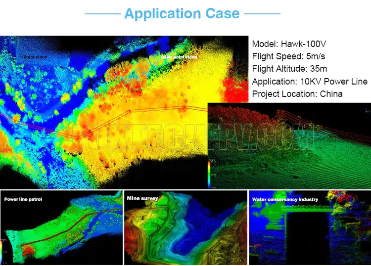
Foxtech Hawk-100V is a compact Lidar point cloud acquisition system, integrated with a laser scanner, GNSS satellite positioning system, INS inertial navigation system, and 26MP camera, which can quickly obtain high-precision point cloud data and rich image information. It is widely used in city construction, forestry, agriculture, land planning, geological disasters, mine safety.
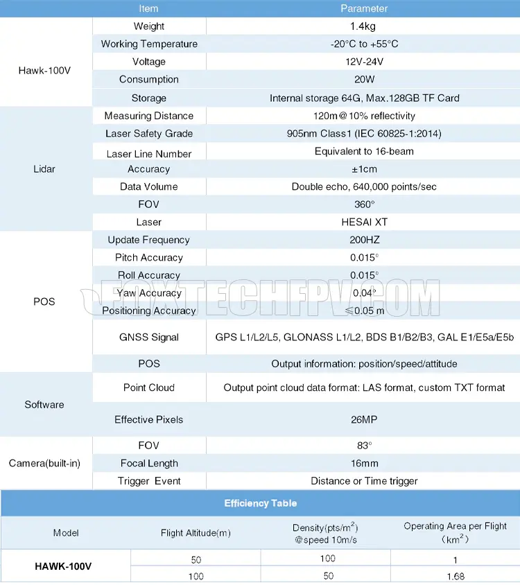
Hawk-100V Lidar Scanning System features 360° FOV, high point density (double echo, 640,000 point/sec), and high accuracy, the positioning accuracy is less than 5cm. The max measuring range is 110m.
Owe to the lightweight and compact size, Hawk-100V Lidar can be used for many different applications, such as objects classification and extraction, creating digital elevation models (DEMs) of specific landscapes, highlighting changes and abnormalities of vegetation growth.
Your Purchase Includes:
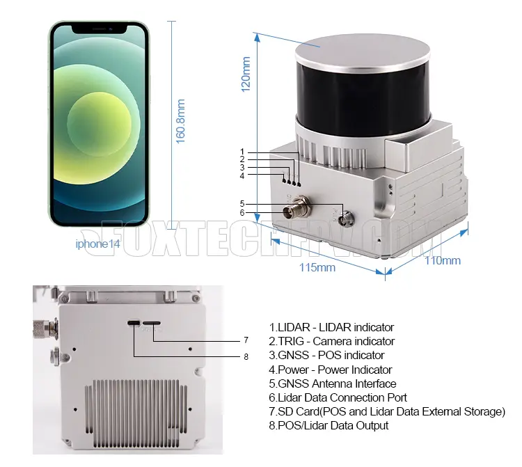
1x Foxtech Hawk-100V Lidar Scanning System
1x GNSS Antenna
1x GNSS Cable
1x Power Connection Cable
1x MICRO SD Card 128 GB
1x U Disk
1x Carry Case


