


Category
Browse By
- Category
-
- Heavy Lift Drone (10)
- Long Time Drones (23)
- Agricultural Drone (2)
- Hybrid Power Drone (9)
- Professional Camera Drone (6)
- VTOL Drone (21)
- Power System (21)
- Generator/Engine (2)
- Propeller (90)
- Flight Controller (2)
- Data Link (9)
- HD Video System (17)
- Camera for Drones (32)
- Sensor (11)
- Battery (22)
- Radio System (7)
- Ground Station (7)
- Tethered Power System (2)
- Accessories (49)
Featured Products
")


-
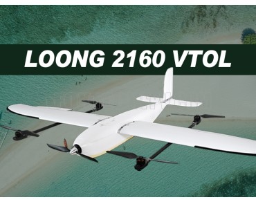 $100,000.00Foxtech Loong 2160 VTOL is a quick-assemble, reliable high performance VTOL specifically design for mapping. It features aerodynamic shape with 2160mm wingspan and 1200mm fuselage. The quick-assemble design allows you to assemble it easily without any tools. Made from EPO and reinforced by carbon tubes that are of high tensile strength and low weight, the whole frame is durable and portable, weighing only 1kg. “4+1” motor design, Map-01, Map-A7R, 3DM V3 or Argus V2, ads001
 -
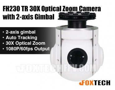 $4,599.00FH230 TR is a 2-axis high precision gimbal with a 30X zoom camera. This gimbal can be mounted on VTOL airplanes or other UAVs for applications like inspection, surveillance, search and rescue.
 -
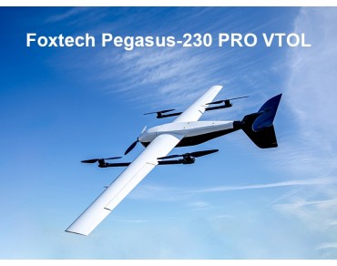 $100,000.00Foxtech Pegasus-230 PRO is an easy-to-use VTOL specifically designed for mapping and inspection.
 -
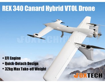 $141,999.00REX 340 is a high-performance VTOL drone, providing solutions for inspections, mapping and survey, traffic monitoring, logistics, etc.
 -
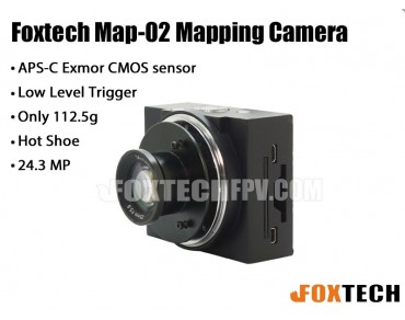 $1,149.00Foxtech Map02 is a lite version mapping camera with APS-C Exmor CMOS sensor and 24.3 MP. It is a good option for higher-quality mapping and survey.
 -
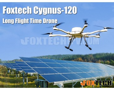 $100,000.00Foxtech Cygnus-120 is a reliable drone with 60min (no payload) long flight time and max 5kg loading capacity for mapping jobs and long range inspection.
 -
 $100,000.00Hunter-900 combo is an object identification & tracking solution, which can be used for car and human recognition&tracking in public security, field search and rescue, military reconnaissance and achieve drone target-following flight.
 -
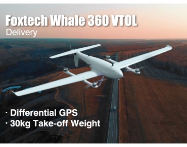 $100,000.00Foxtech Whale 360 Heavy Lift VTOL for delivery with differential GPS(DGPS, Dual GPS) and 5kg payload capacity, features long endurance, fast cruising speed and long range.
 -
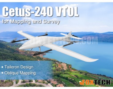 $100,000.00Cetus-240 VTOL featuring highly advanced aerodynamic design is a long flight time VTOL for survey and mapping.
 -

From: $10,758.00
To: $15,558.00
NAGA Quadcopter Mapping Package is a small size aerial platform of unrivalled performance for mapping, surveillance and inspection.
Payment


Shipment


